Search every decreed water right on record
Fill in any combination of criteria — county, division, district, structure type, decreed use, structure name, WDID, case number, water source, decreed amount — and press Search. Results come back one row per decree, most senior first, with exact totals. Two searches no other public tool runs: follow a river upstream onto its tributaries, and search around a street address. Expand any row for its recorded court filings and a year-by-year diversion history; any WDID opens the full dossier.
Follow the river upstream
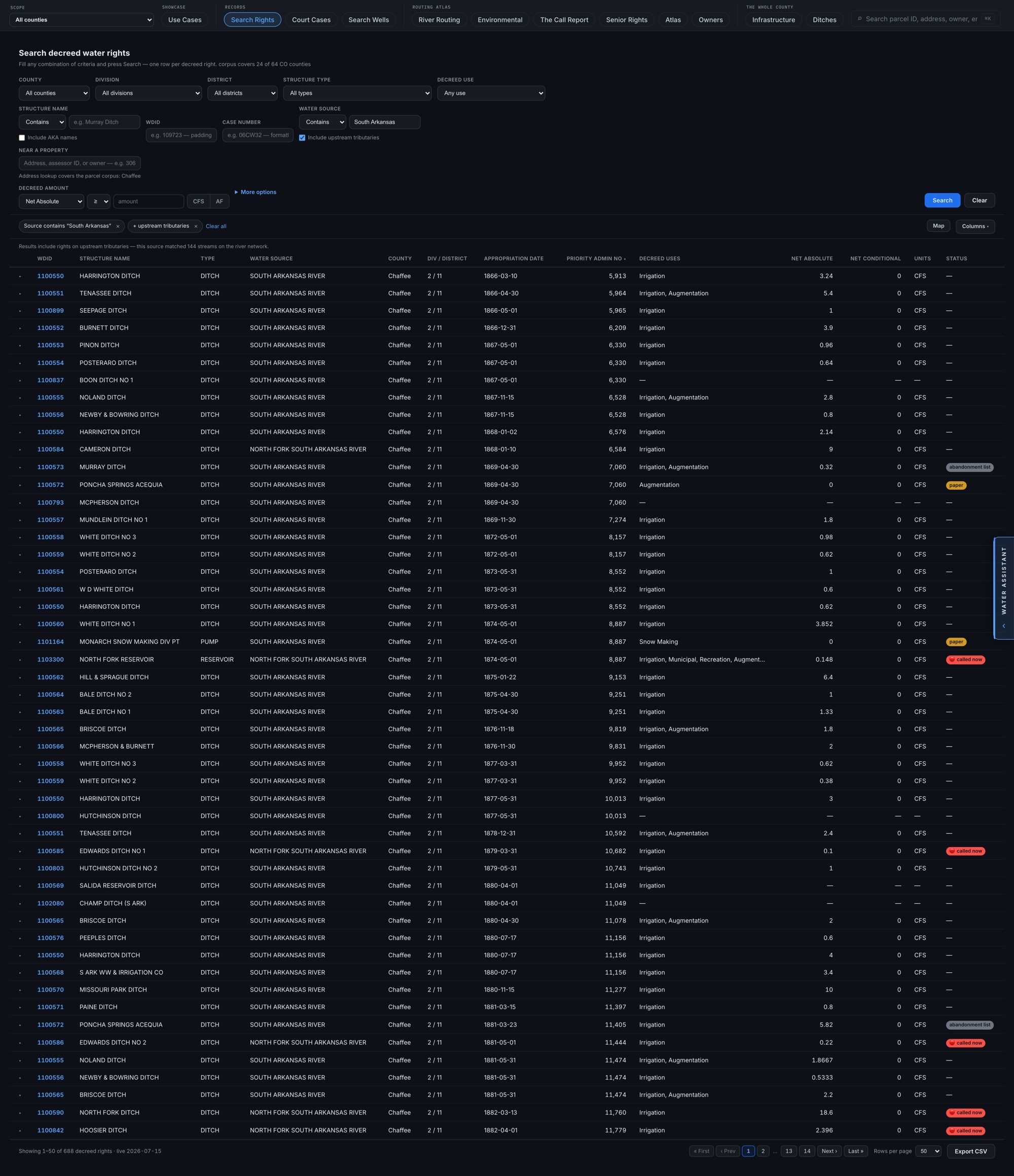
One checkbox widens a water-source search onto every right that diverts from the source’s upstream tributaries — matched by the actual river network, not by name text. A name search for “South Arkansas” can’t know that Fooses Creek drains into it; the river network does, and the search says exactly what it did — in the example, this source matched 144 streams. A source with no mapped corridor says so rather than quietly widening.
Search near a property
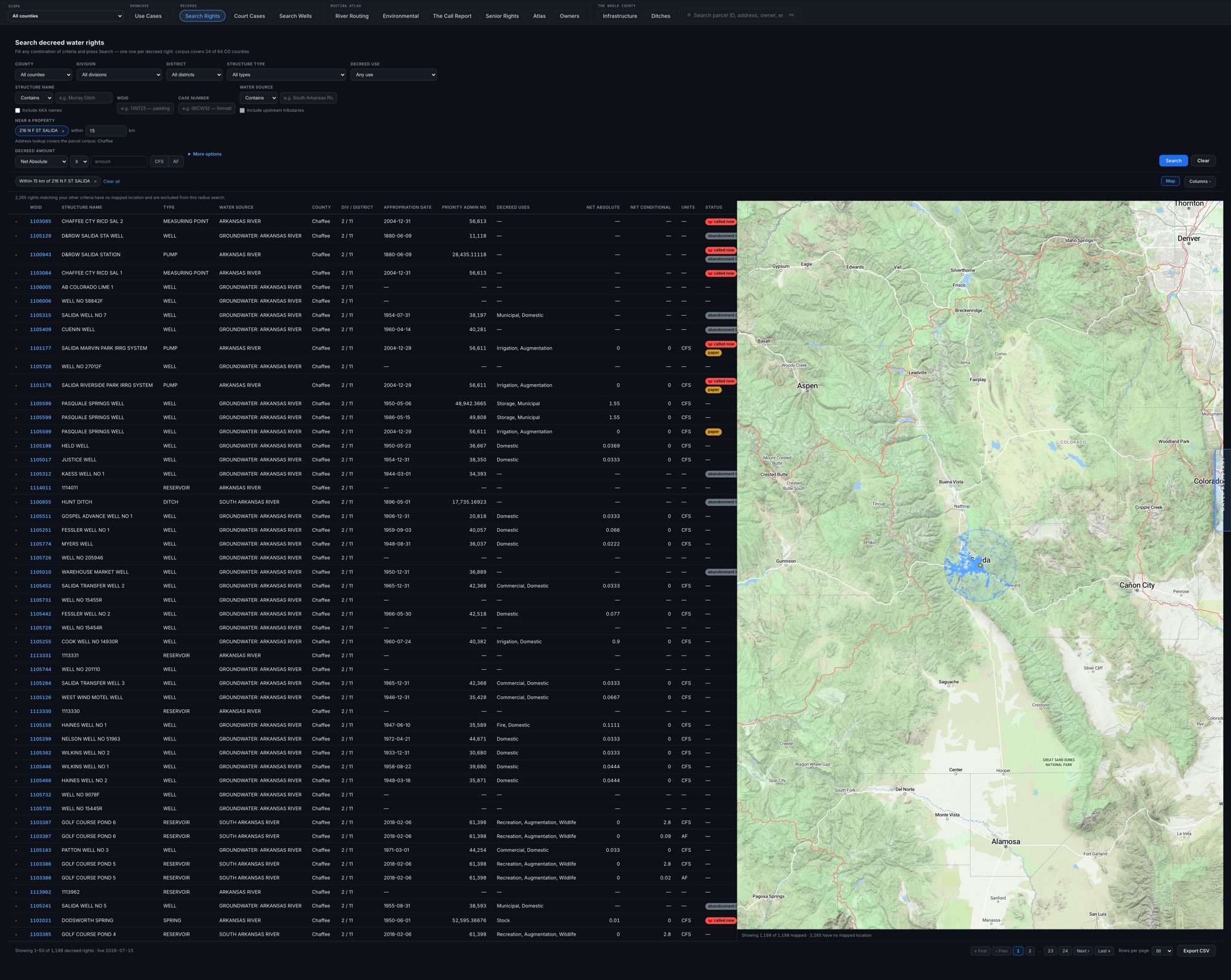
Type a street address, pick the parcel, and search every decreed right within a radius of it — nearest first, with the distance in every row and the matches plotted on a map beside the grid. The example runs 15 km around a Salida address. Rights with no recorded location are counted and disclosed, never silently dropped.
One row per decree
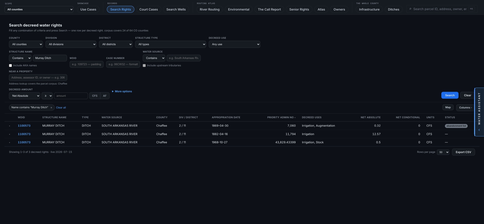
A ditch is not one water right. Searching “Murray Ditch” returns three rows — separate decrees from 1869, 1882, and 1968, each with its own priority number, decreed rate, and uses. In the example, the 1869 decree sits on the state abandonment list while the other two stand clear — standing is per decree, and the search shows it that way.
Seniority, oldest first
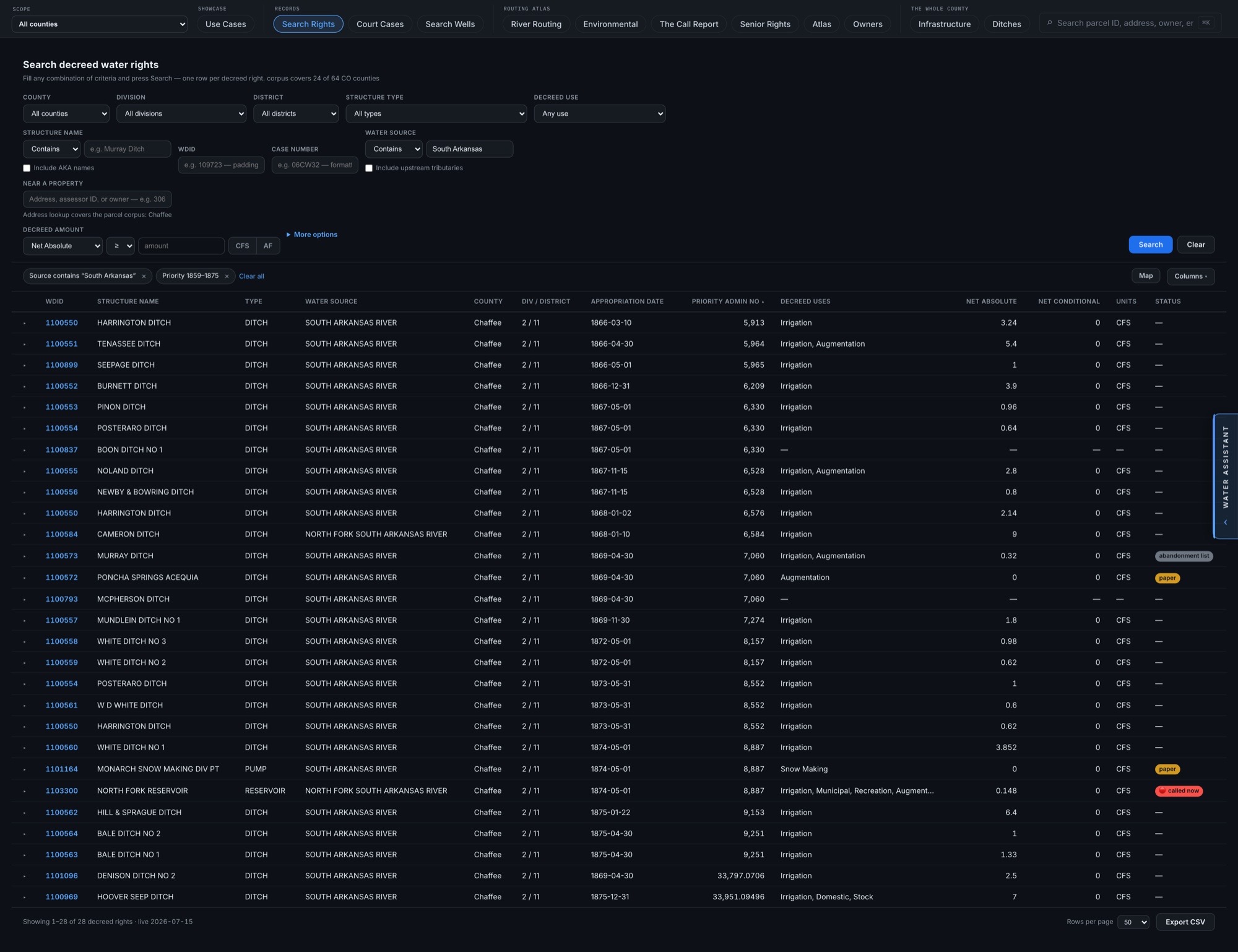
Filter by water source and priority era: every right on the South Arkansas River decreed before 1876, most senior first. Rights on the abandonment list, paper-only rights, and rights under an active call are flagged in the rows. The most senior result — Harrington Ditch, decreed 1866 — is the same ditch featured in the dossier example.
Filters, forgiving identifiers, CSV
Narrow further by decree class (absolute or conditional), decreed use, abandonment-list status, live call status, and recorded recent use — or widen a name search to a structure’s recorded aliases. Case numbers and WDIDs are formatting-forgiving — “06CW32” also finds rights filed under “06CW0032”, and the interpretation is shown with the results. The whole match set exports to CSV with plain-English headers.